

 Las altas temperaturas están provocando que las lagunas y las marismas de Doñana pierdan agua rápidamente


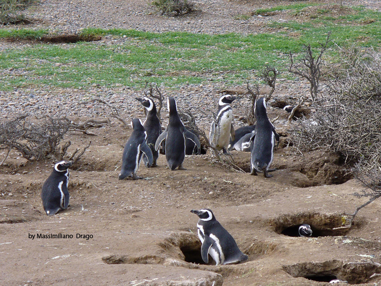
Identifying priority areas for biodiversity conservation is particularly challenging in the marine environment due to the open and dynamic nature of the ocean, the paucity of information on species distribution, and the necessary balance between marine biodiversity conservation and essential supporting services such as seafood provision. The Patagonian seabird breeding community was used as a case study to propose an integrated and adaptive method for delimiting key marine areas for conservation. Priority areas were defined through a free decision-support tool that included projected at-sea distributions of seabirds; BirdLife Important Bird and Biodiversity Areas for pelagic bird species; and the economic costs of potential regulations in fishing practices. The proposed reserve network encompassed approximately 300,000 km2 that was largely concentrated in northern and southern inshore and northern and central offshore regions. This reserve network exceeded the minimum threshold of 20% conservation of the abundance of each species proposed by the World Parks Congress. Based on marine currents in the study area, the 3 primary water masses that may influence areas of conservation priority through water inflow were further identified. Reserve network may benefit from enhanced marine productivity in these highly connected areas, but they may be threatened by human impacts such as marine pollution. This method of reserve network design is an important advance with respect to the more classical approaches based on criteria defined for one or a few species and may be particularly useful when information on spatial patterns is data deficient. This approach also accommodates addition of new information on seabird distribution and population dynamics, human activities, and alterations in the marine environment. informacion[at]ebd.csic.es: Afán et al (2018) An adaptive method for identifying marine areas of high conservation priority. Cons Biol DOI: 10.1111/cobi.13154
https://doi.org/10.1111/cobi.13154